Taxify Now Available On Google Maps

Taxify has today announced that customers will now be able to get an estimate for a Taxify ride, duration and fare in Google Maps right next to other transport options.
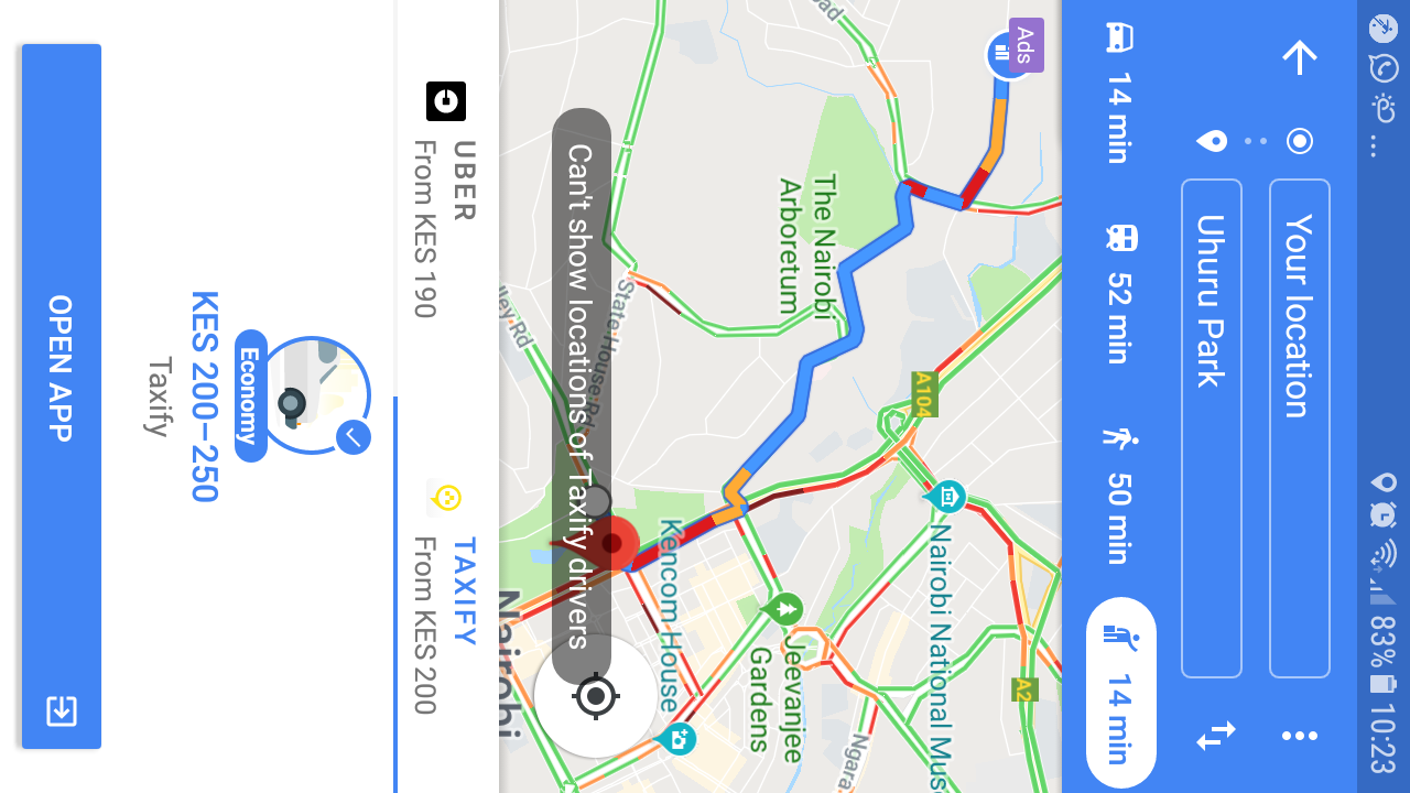
The new option will require customers to open the Google Maps app on their smartphone. After searching for their destination, they’ll need to tap Directions and open the ride services tab next to the familiar car, public transport and walking options.
The tab will display information about how close Taxify cars are as well as an estimated fare. After selecting Taxify as their ride and tapping on “Open app”, it will open up the Taxify app so you can complete booking the ride. Customers without the app on their device will be prompted to install Taxify first.
Read: Nokia Serves First Slice Of Android 9 Pie On Nokia 7 Plus
“”Having Taxify as part of the transit options on Google Maps; makes it easy for riders, as it offers them comparisons between estimated arrival times, as well as fare options. This saves them time and money,” said Shivachi Muleji, Taxify General Manager East Africa.
Taxify rides in Google Maps are rolling out globally today and will be available in over 15 countries. These include Kenya, Australia, Austria, Azerbaijan, Czech Republic, Estonia, France, Hungary, Iraq, Nigeria, Poland, Slovakia, Mexico, Romania, South Africa and Georgia.
2 thoughts on “Taxify Now Available On Google Maps”